Leicestershire
Leicestershire is located in the heart of England and has an estimated population of 650,500. Leicestershire is an attractive rural county and encompasses eighteen diverse landscape character areas, including The Wolds, Charnwood Forest, High Leicestershire and the Soar Valley.
The county contains the National Forest, one of the boldest environmental projects in the country, along with a range of country parks and areas of outstanding natural beauty.
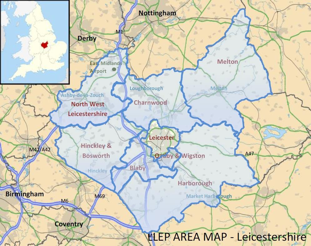
Leicestershire comprises seven local authority districts, each with its own distinctive character. These are:
- Blaby
- Charnwood
- Harborough
- Hinckley and Bosworth
- Melton
- North West Leicestershire
- Oadby and Wigston
Some of the key settlements within Leicestershire include:
- Blaby (Blaby District)
- Loughborough and Shepshed (Charnwood)
- Hinckley and Earl Shilton (Hinckley and Bosworth)
- Market Harborough and Lutterworth (Harborough)
- Coalville and Ashby-de-la-Zouch (North West Leicestershire)
- Melton Mowbray (Melton Borough)
- Oadby, Wigston and South Wigston (Oadby and Wigston).
Leicestershire is a rural county and has over 300 settlements. The majority of these are very small. Agriculture accounts for 80% of all land use.
The information in the related labour market dashboards [insert link] refers to the Leicestershire economy.